
Hawk Map GPS-GIS
Maps & Navigation
![]() 4.6
4.6![]() 100K+
100K+
Editor's Review
This app is a modern version of our "Mgrs & Utm Map" application.
GPS and coordinate systems helper especially for military personnel.
It is also a complete helper for airsoft, mountaineering, trekking and hiking, cross running, scouting, hunting, fishing, geocaching, off-road navigation and all other outdoor activities and sports.
With satellite navigation systems such as GPS, GALILEO and GLONASS (GNSS) supported by your device and your sensors, you can see your most accurate position on different map layers.
⭐⭐Features⭐⭐
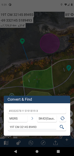
👉 Coordinate Indicator, finder and converter
Format options:
- D°M'S" (WGS84)
- Latitude/Longitude (WGS84)
- UTM (WGS84/NAD83),
- MGRS / U.S. National Grid (USNG) (WGS84/NAD83)
- SK42(Gauss Kruger)
- British National Grid(BNG-OSNG)
- Irish Grid Reference
- ED50 (6°-3°)
- ITRF (6°-3°)
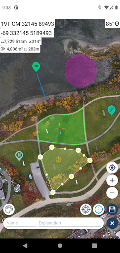
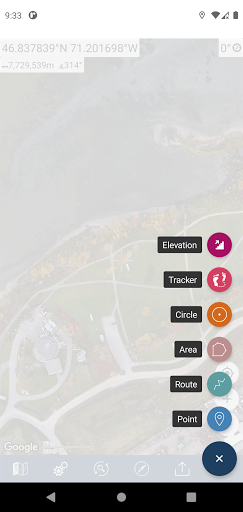
👉 You can make colored markings on the map.
Markers,Polygons,Polylines,Circles
👉 Area & Distance measurement
Distance unit options: m , ft , mi , yd , nmi
Area unit options: m² , ha , ft², yd², mi²
👉 Elevation information
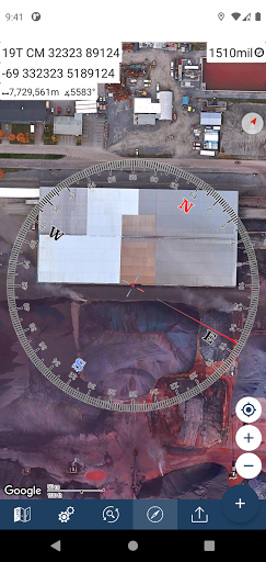
👉 Compass
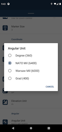
Angular unit options: Degrees ,NATO mil, Warsaw Mil, Grad
👉 Map style options: (Road,Terrain,Satellite,Night Mode,Hybrid)
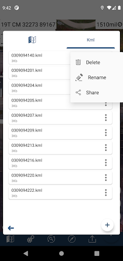
👉 KML viewer. (Export and import KML layers).
👉 GPS track recorder.
ADVERTISEMENT
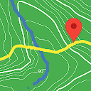
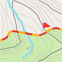
Screenshots

Recommend

GPS Waypoints Navigator | MAPS
Maps & Navigation
![]() 4.5
4.5
GIS Mapper - Surveying App for
Maps & Navigation
![]() 2.2
2.2
Topo GPS
Maps & Navigation
![]() 0
0

Maps Measure
Travel & Local
![]() 4.2
4.2

CityMaps2Go Offline maps
Maps & Navigation
![]() 4.2
4.2

Guru Maps — GPS Route Planner
Travel & Local
![]() 3.9
3.9
BackCountry Navigator GPS PRO
Maps & Navigation
![]() 3.8
3.8

Enroute Flight Navigation
Maps & Navigation
![]() 4.5
4.5

Tactical NAV: MGRS Navigation
Maps & Navigation
![]() 3.9
3.9

Mergin Maps: QGIS in pocket
Productivity
![]() 4.5
4.5
BackCountry Navigator XE: Topo
Maps & Navigation
![]() 3.6
3.6
ADVERTISEMENT