ADVERTISEMENT

OpenRunner : bike & hike maps
Sports
![]() 100K+
100K+
Editor's Review
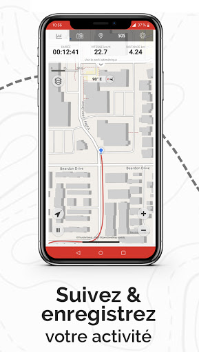
The Openrunner app is your partner for all your outdoor activities. Acting as a real GPS it enables you to locate and visualise your position as well as your progress on topographic maps. It also provides information of the number of kilometres, altitude, cumulated height difference, etc. To ensure your friends and family can keep track of your movements the app features a function that informs a selection of your contacts of your position in real-time.
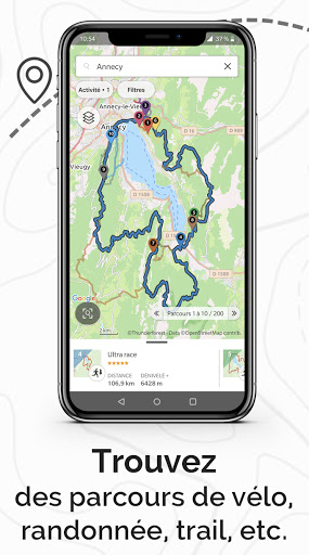
The app enables you to access all the routes recorded on the www.openrunner.com website and also all of the public routes available (> 5,000,000).
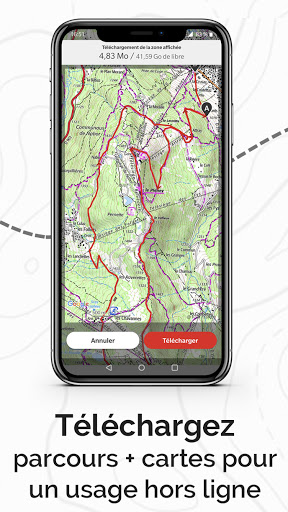
The app has a feature that lets you download topographic maps to ensure that these can be displayed out in the field, even in zones that are not covered by a 3G/4G network. An off-line mode is also available to limit network access to a strict minimum and preserve your phone battery as much as possible when using the app.
You need to create a free account and to log on to the site. Access to topographic maps requires an annual or monthly subscription.
List of functionalities:
- Find all your programmed routes on the www.openrunner.com website and let yourself be guided by app to follow them in the field.
- Search for routes close to your position or within the zone of your choice.
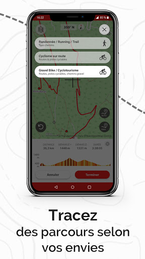
- Download topologic map to use off-line. This will ensure you are able to display the map background regardless of 3G/4G coverage and will preserve your phone battery by using your smartphone as a real outdoor GPS.
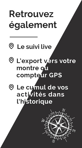
- Live Tracking: Keep your friends and family informed in real time of your position and movements at all times during your outdoor activity.
- Record all your outdoor activities and transfer them to openrunner.com to share them or make changes to them.
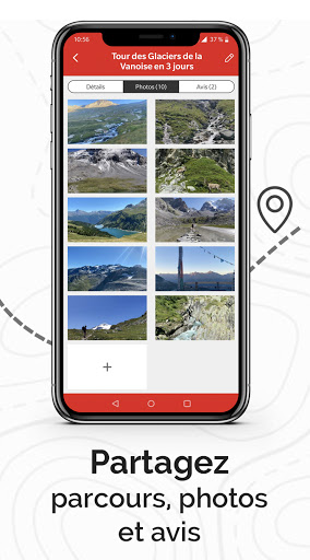
- Take pictures while you record your activity so as to associate them with your route.
- Add community POI to inform users of roadworks and useful information (ex: gravel on the road, road closed).
Continued use of GPS running in the background can dramatically decrease battery life.
ADVERTISEMENT
Screenshots