ADVERTISEMENT

savvy navvy : Boat Navigation
Maps & Navigation
![]() 4.3
4.3![]() 100K+
100K+
Editor's Review
Everything you need to get out on the water, if you are a boater, sailor, paddleboarder, Jet skier, Kayaker or just going fishing, we’ve got you covered.
Free Features -
• All USA nautical savvy charts TM
• Weather Forecast
• Departure scheduling
• Record GPS Tracks
• Automatic weather routing, including Course to Steer(CTA)
• Marina information at the touch of a button.
• And much more
One app, multiple devices.
Premium Features
• Unlimited Worldwide savvy charts TM
• Multi-day weather forecast
• Unlimited GPS Tracks
• Multi-day Departure Scheduler
• Offline charts and weather
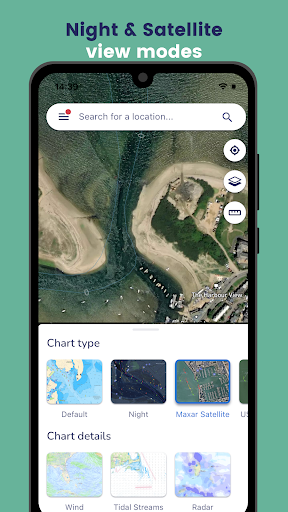
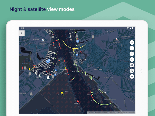
• Satellite chart overlay
• Anchor Alarm
savvy navvy put all the essential marine information you need, in one place. Tides, Tidal graphs, weather forecasts, automatically updated chart data, routing, GPS tracking, marina information (and more) at the touch of a button. One subscription, one app, multiple devices - it doesn't matter if you are on a motor boat, sailing yacht, SUP Paddleboard, Kayak or jetski.
FEATURES
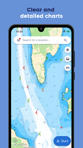
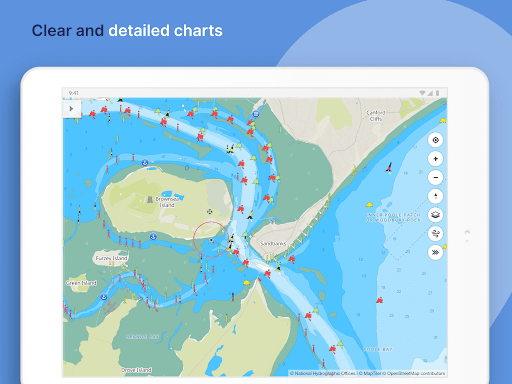
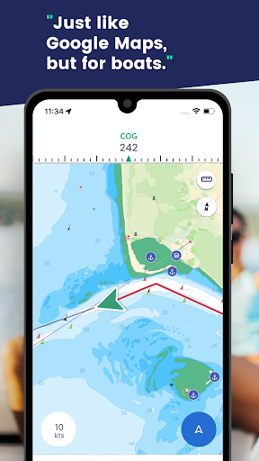
CHART NAVIGATION
Get access to all savvy charts, wherever we have coverage. Our sailing maps have been custom-built using quality data from NOAA, UKHO and other hydrographic offices around the world to provide easy and safe sailing navigation - like a chart plotter in your pocket.
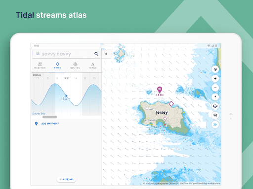
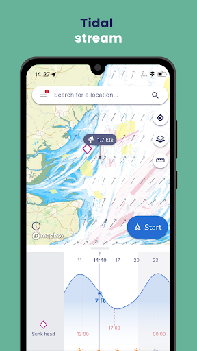
TIDE HEIGHTS GRAPH & TIDAL STREAMS
View tidal heights and tidal current or streams on our tide chart. Scroll through the tidal graph to see changes in tidal highs and lows over time.
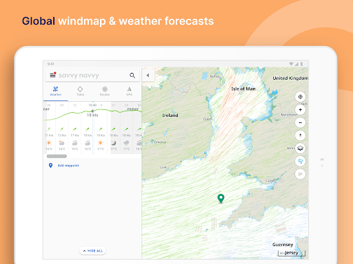
MARINE WEATHER FORECASTS
Use the weather forecast graph to scroll through days and times to see the effect on weather conditions, wind strength and direction. Use the wind icon to see a visual overlay of wind barbs!
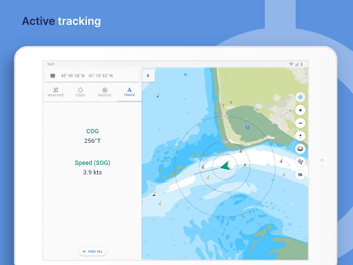
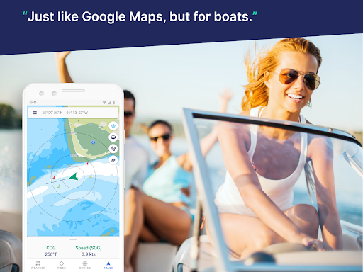
ACTIVE TRACKING
Use boat tracking to hone in on your boat GPS location, see your course over ground (COG) and view your speed over ground (SOG). savvy navvy is essentially your nautical GPS giving you a compass heading to steer with a tide calculation!
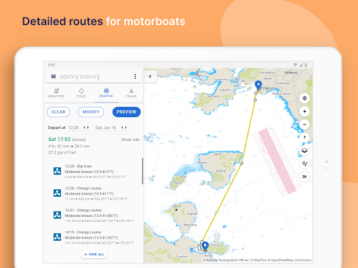
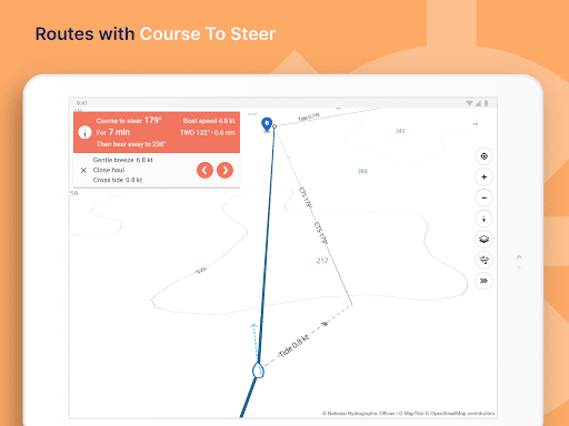
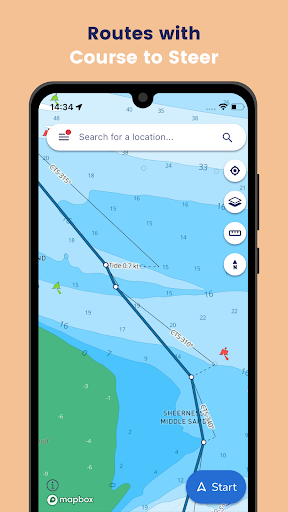
AUTOMATIC ROUTING
Plot a sailing route in seconds with an automatic course to steer. Drop a pin to indicate your start and finish points and savvy navvy will quickly plot a route to sail taking into account wind, chart and tidal data.
1. Drop a pin at your start and finish locations
2. Calculate your route
3. Preview your route and get an Estimated Time of Arrival
4. Export your route for use with your chart plotter
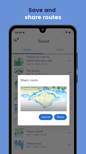
ROUTE EXPORT
Marine navigation made easy! Plot your route with savvy navvy and then export the GPX file for use with your chart plotter. Boating navigation couldn’t be easier!
ANCHOR ALARM
An addition of an Anchor Alarm functionality to keep you safe when anchored. Allows the user to set a drift/swing area, which you will receive a warning if crossed.
MARINA & ANCHORAGE INFORMATION
Tap our dedicated icons for local marina and anchorage information on our sailing map and find:
* VHF channel
* Anchorage holding
* Overnight weather and wind direction information
* Mooring details
* Restaurants, bathrooms and toilets
* Fuel docks
* Water
* And much more...
DEDICATED CUSTOMER SERVICE
Our team is on standby to help you whenever you need us for questions about boating navigation, sailing, the chart plotter or anything else. Our in-app chatbot is managed by real team members with extensive experience in marine navigation who will help you get the most out of your boat navigation app!
ADDITIONAL VESSEL TYPES
Support for Paddleboarders, Kayakers and Jetskis
We added new vessel types into our on-water family, giving them the same features and functions that are tailored specifically to them.
ADVERTISEMENT
Screenshots