ADVERTISEMENT

UAV Ground Control
Tools
![]() 500+
500+
Editor's Review
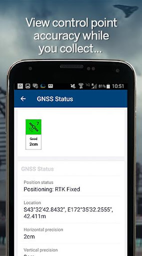
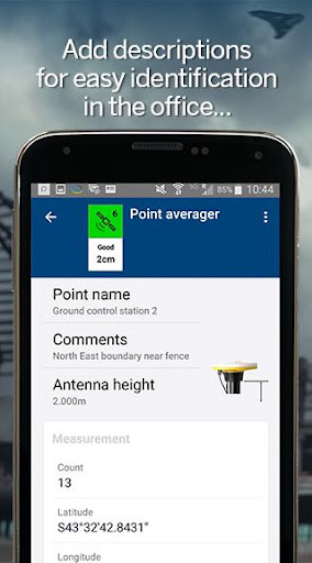
UAV Ground Control is a Trimble application for collecting ground control points for UAV mapping. The app enables Android powered mobile phones and tablets to collect ground control points with centimeter accuracy using real-time positioning services.
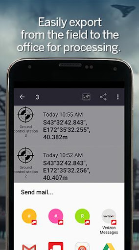
Once collected, you can use UAV Ground Control to export the control points for use in your UAV processing software and produce accurate aerial imagery or basemaps.
KEY FEATURES:
* Simple collection of accurate ground control points using either Trimble Catalyst or Bluetooth receivers
* Sign-in to the positioning service from UAV Ground Control
* Average the RTK positions for as long as required to achieve your accuracy target
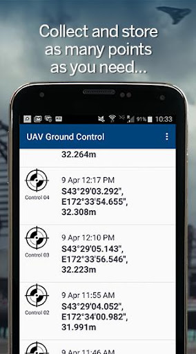
* Collect as many points as required by your mapping processing software
* Select the points required for the processing software to map project
* Share via email in a simple CSV format.
*** NOTE: The Trimble Catalyst positioning service requires a free Trimble user account, a Catalyst DA1 antenna and a subscription to the Trimble Catalyst softGNSS positioning service. Visit https://catalyst.trimble.com for a list of subscription options and purchasing details. ***
Where available, the CSV file contains the EPSG code to ensure the processing software can use the correct datum and map projection.
LICENSE AGREEMENT:
Refer to Trimble's EULA for Terms of Service for Trimble Catalyst and UAV Ground Control. By installing this app, you agree to these terms and conditions. IF YOU DO NOT ACCEPT THEM, DO NOT USE THE SOFTWARE. https://catalyst.trimble.com/legal/EULA.html
ADVERTISEMENT
Screenshots