ADVERTISEMENT
Wildfire Info
Weather
![]() 3.8
3.8![]() 50K+
50K+
Editor's Review
Disclaimer: This unofficial app does not represent any government agency and is not affiliated with any government agency. The sources of the data are the publicly accessible sources listed below.
Browse current wildfire and prescribed burn activity throughout all of the world.
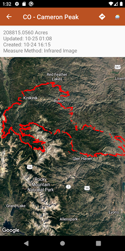
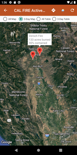
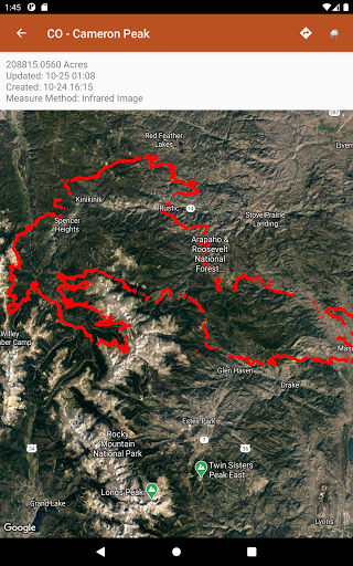
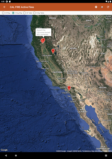
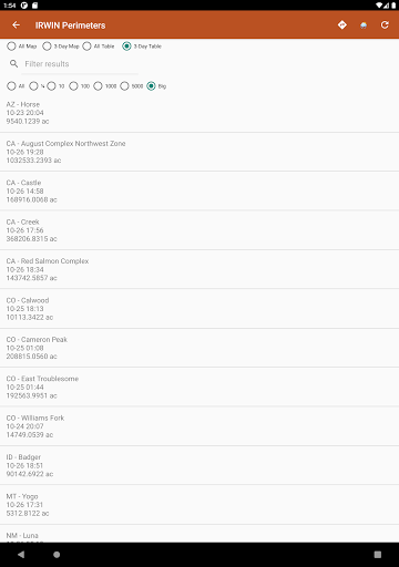
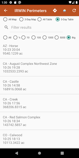
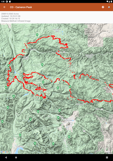
Active Wildfire Perimeter data from WFIGS updated every 20 minutes. Tagged by state, search by name, and filter by acres burned. WFIGS stands for the Wildland Fire Interagency Geospatial Services (WFIGS) Group
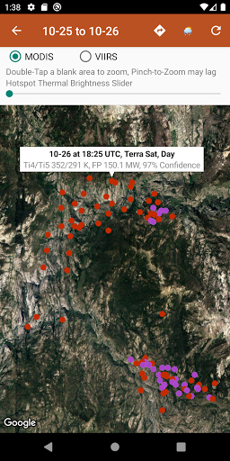
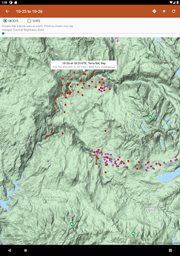
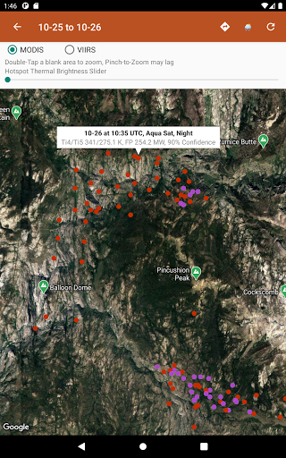
NASA MODIS and VIIRS satellite instruments data: Thermal hotspot maps by region show wildfire activity in the past 48 hours. See hotspot info including fire radiance power, brightness temperature, and confidence.
Air Quality data (PM 2.5, PM10, and Ozone) globally from EPA AirNow and PurpleAir.
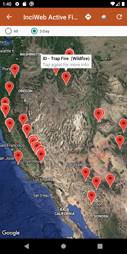
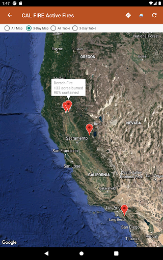
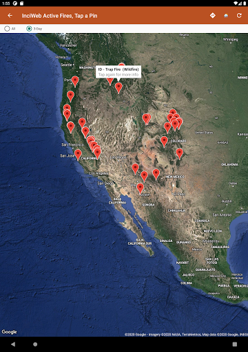
InciWeb & CAL FIRE active fire maps: hot-link to the corresponding official incident webpage.
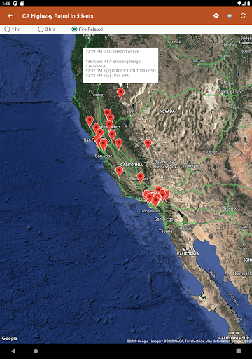
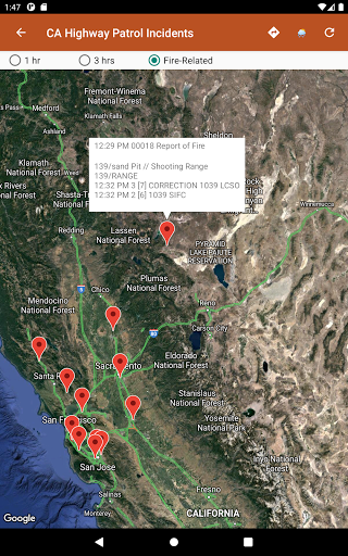
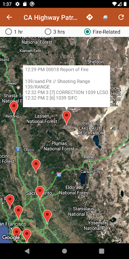
CHP (California Highway Patrol): Incidents in the past 3 hours related to fires are filtered out separately, all traffic incidents are included viewable by last 1 or 3 hours.
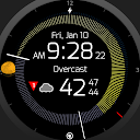
Links to current hyper-local weather summary conditions from NWS, NOAA, Government of Canada, and Government of Australia: including temperature, wind and gust conditions, and local forecasts anywhere in the USA, Canada, or Australia at your centered map location.
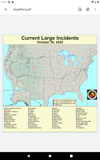
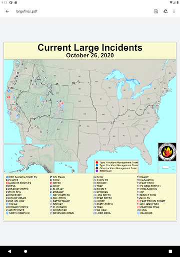
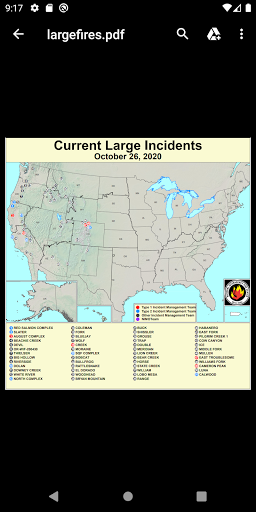
Wildfire Situation Reports section with mirrored PDFs from NIFC and more.
Pull up the Google Maps app for an area with the embedded deep links.
There is a section for wildfire-related US government Twitter accounts viewable by map by approximate location or sorted into national and state sources in a table view.
Information is posted as soon as it becomes available from WFIGS, NIFC, NASA, InciWeb, CAL FIRE, CHP, NOAA, NWS, Government of Canada, and Government of Australia.
ADVERTISEMENT
Screenshots