ADVERTISEMENT

Air Navigation Pro
Maps & Navigation
![]() 3.2
3.2![]() 100 mil+
100 mil+
Revisión del editor
Discover our flight planning & realtime navigation app free for 14 days!
- Everything you need to fly in the entire world in one app
- Plan your flight within minutes
- Fly relaxed with updated and live information
Air Navigation Pro is a high-quality flight assistant app, with real time GPS navigation for VFR pilots all over the world. You will find the following main features :
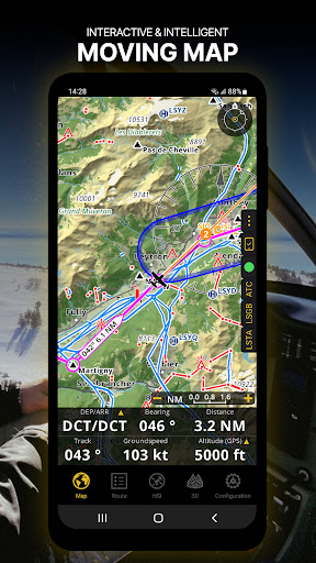
MOVING MAP AND FLIGHT PLANNING FUNCTIONS
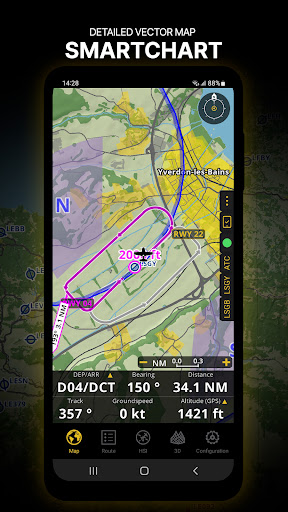
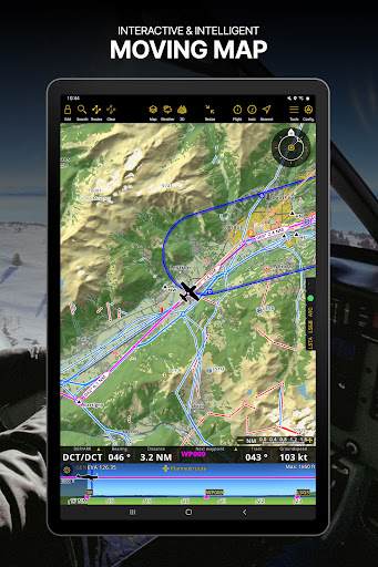
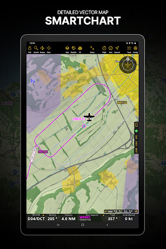
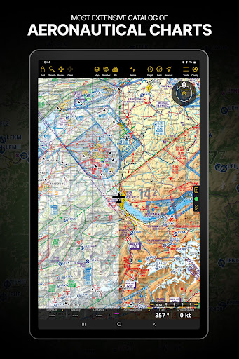
The Moving Map displays aeronautical charts as background, interactive waypoints, airspaces and planned route. Plan and edit with the Flight Planning function, directly from the moving map or by searching the waypoint’s database. The planned route will be displayed on the moving map together with further information such as next point distance, track, heading and many more.
APPROACH CHARTS
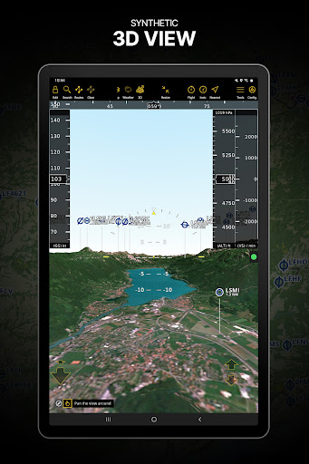
The georeferenced approach charts are designed for maximum visibility. Displaying now also in the 3D view, they provide increase awareness of your surroundings during take-off and landing.
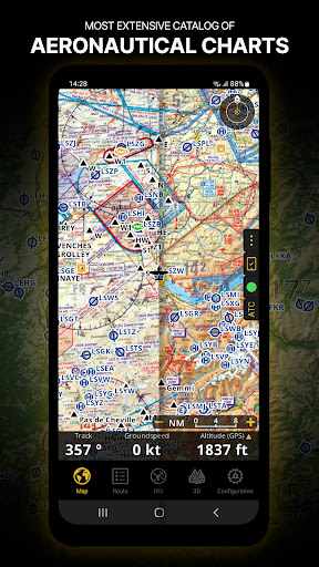
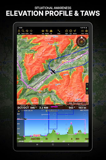
AERONAUTICAL CHARTS, PROFILE VIEW AND 3D VIEW
We provide a worldwide selection of charts including the main ICAO charts. The Profile View gives all terrain information for better situation awareness and safety enhancement. The 3D view provides enhanced terrain awareness and is compatible with georeferenced approach charts.
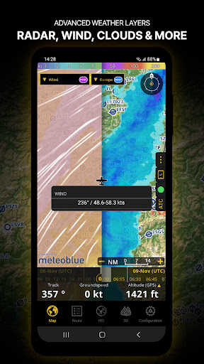
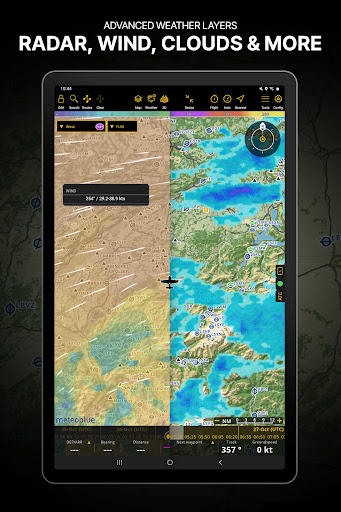
WEATHER (included in all Premium and Smart+ packages):
Review weather forecast for up to 3 days ahead
Display data: Rain Radar, Wind, GAFOR (CH&DE), Pressure, Clouds and rain, Visibility, Gust, on your moving map
Create your flight briefings including weather charts and graphs
Weather data is updated multiple times a day
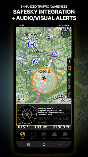
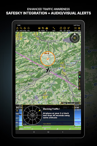
INSTRUMENTS, ALERTS, AND TRAFFIC AWARENESS
Simulate aircraft instruments, using the information from GPS and other sensors. Set a wide range of alerts customized to your needs, for example to notify you when a target altitude has been reached or abandoned.
Enhance safety with the Traffic Awareness feature by decreasing the risk of a collision, fly simultaneously or follow another aircraft that you marked*
*requires GSM internet connection or an external device
DATABASE AND SEARCH ENGINE
Global aeronautical database with over 215,000 waypoints and 55,000 airspaces constantly being updated. Search and navigate to specific locations. Also create, edit and export custom waypoints and routes and create aircraft profiles for both helicopters and airplanes.
AUTOMATIC LOGBOOK, FLIGHT PLAN AND BRIEFING
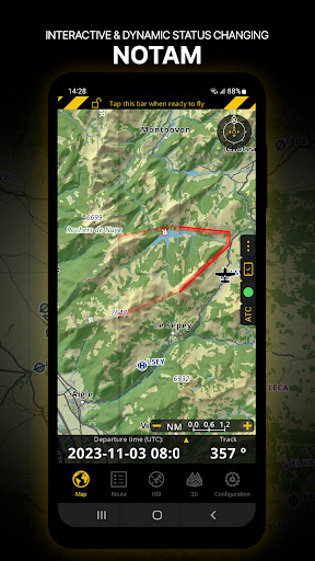
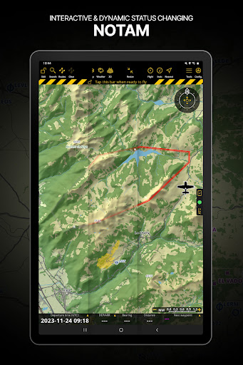
The Logbook uses GPS information, and is automatic and fully editable. It can be shared via email or via the integrated webserver. Create different files, like the Operational Flight Plan or the NOTAMs Briefing, that will help you document your flight and follow your plan as you communicate with Air Traffic Services. Interactive NOTAM, which will automatically appear on the moving map, are now included in our packages.
LIVE TRACKING, FLIGHT RECORDING
Follow your flight in real time, record your flight, replay and analyze your trace. The recorded flight can also be exported as KML file and be viewed on Google Earth.
ADDITIONAL FEATURES
Moving Map optimized for day and night operation
Weight and Balance Computer
Supports external sensors
And many more...
REQUIREMENTS
iPads “WiFi only” don’t include an internal GPS receptor, an external sensor is needed for these devices. Check out our User Manual on our Website : www.airnavigation.aero
ADVERTISEMENT
Capturas de Pantalla