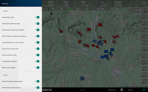
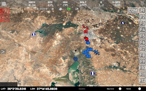
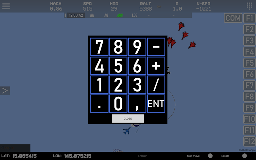
DCS Nav
Tools
![]() 50+
50+
Revisión del editor
For working You need to download and install Lua export script for DCS World from here:
https://github.com/pet333r/pw-dev_script
Detailed information on how to add a script to DCS World can be found on the same page
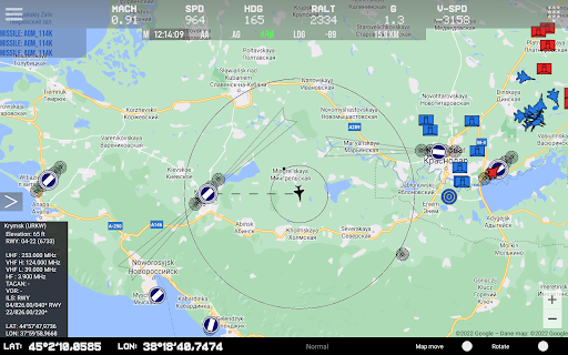
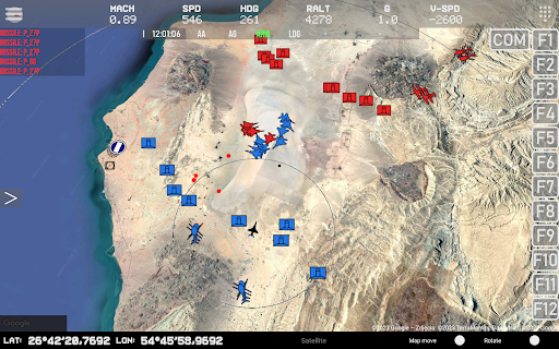
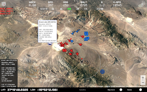
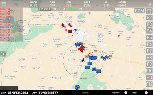
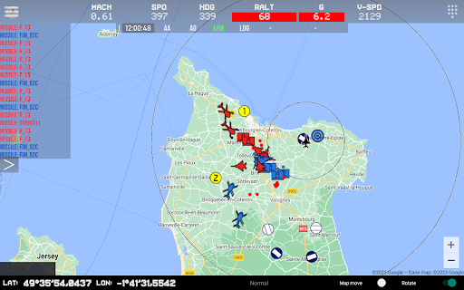
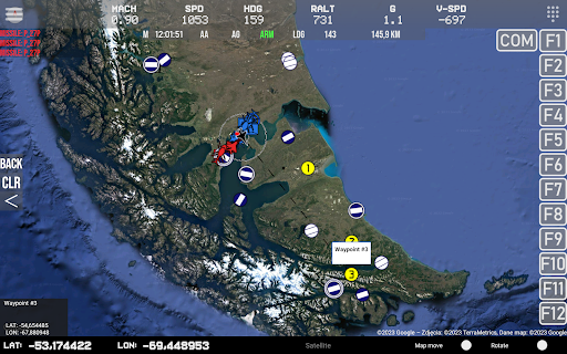
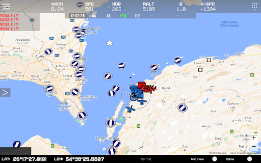
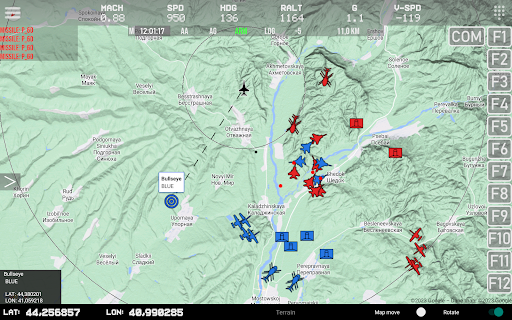
main functions:
- displaying your own position and data
- displaying the radius of a circle around the user module
- displaying the position of other objects: airplanes, helicopters, ships
- SAM launcher position display
- displaying information about current missiles in the air
- displaying airports on the map with information
- display of available ILS tracks with navigation information
- display beacons (TACAN, NDB, VOR etc)
- displaying different icons depending on the type of object
- displaying map boundaries
- displaying NTTR boundaries
- radio altitude limit warning
- change of frequency of data reception from DCS World for individual objects
- ability to enable/disable displaying individual objects on the map
- change of map type
- side menu with the ability to quickly change the display of objects on the map
- support for DCS Util app
ADVERTISEMENT
Capturas de Pantalla


Recomendar

Hawk Map GPS-GIS
Maps & Navigation
![]() 4.6
4.6

AIS Flytomap GPS Chart Plotter
Maps & Navigation
![]() 0
0
Navigation, GPS Route finder
Maps & Navigation
![]() 4
4
Doppler storm radar - eMap HDF
Weather
![]() 4.4
4.4
RadSat HD Pro
Weather
![]() 4.1
4.1

Plane Finder - Flight Tracker
Travel & Local
![]() 3
3

Memory-Map
Maps & Navigation
![]() 3.8
3.8
Weather app - eWeather HDF
Weather
![]() 4.5
4.5

GeoBallistics
Sports
![]() 4
4
RadSat HD
Weather
![]() 3.9
3.9
ADVERTISEMENT