ADVERTISEMENT

Locus Map 4 Outdoor Navigation
Maps & Navigation
![]() 4.1
4.1![]() 5 M+
5 M+
Revisión del editor
More fun(ctions) for your adventures! Multifunctional navigation app with offline maps for a fully enjoyable outdoor experience.
Create, plan, edit, record, save or share your trips, keep the memories, track your performance, and much more. Locus Map is designed for hiking, mountain biking, cycling, running, geocaching, cross-country skiing, and other outdoor activities.
Fully customizable and flexible, offering a wide range of cool functions running above a variety of maps of the whole world.
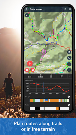
Plan, record and manage your activities:
• plan routes along hiking trails, bike trails, or in an open terrain within the app or on the web
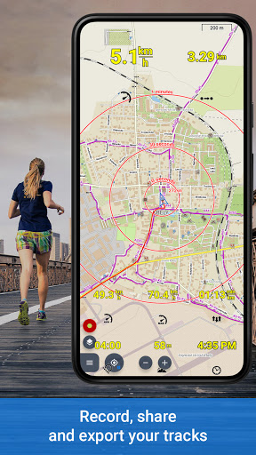
• record tracks with all useful stats – distance, speed, pace, height gain, calorie burn, and other
• import and export the routes in various formats (GPX, KMZ, TCX...)
• share your tracks to Strava, Runkeeper, or Google Earth
• create your private database of interesting or favorite places
• browse your geotagged photos on the map
• import and export points of interest in various formats
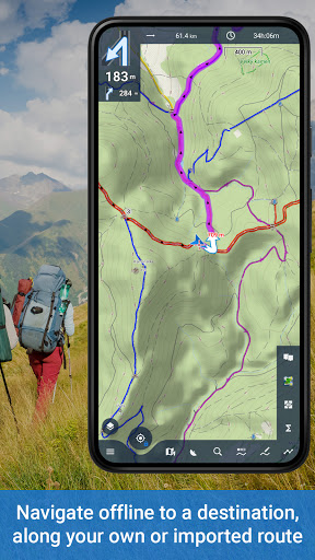
Navigate and guide offline:
• turn-by-turn voice instructions or sound signals
• out-of route alert
• navigation and guidance along routes imported from elsewhere
• beeline guidance in an open terrain
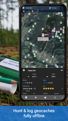
Hunt for geocaches:
• download caches for offline play via G4L add-on
• navigate caches above the map or using the compass, log them online or offline
• use graphic and calculation tools
• manage your logs and drafts
• get alerted of an upcoming geocache
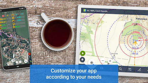
Customize your app:
• configure its main menu according to your actual needs
• set the main screen - function panels, right/left-hand control, light/dark mode...
• set coords system, units, dashboards and screens
• enjoy the app’s flexibility with the configuration presets
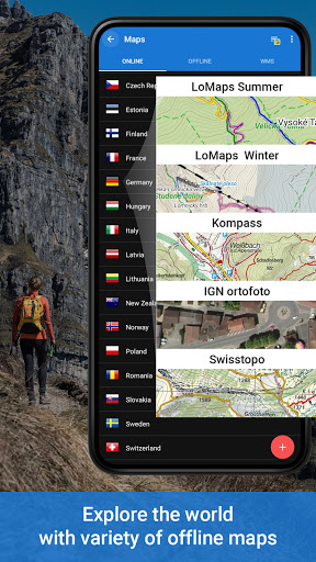
Use maps from our wide selection:
LoMaps - online/offline maps of the whole world
• switchable to hiking/biking map, winter or city map. Download 3 of them for FREE.
Global satellite maps
• Here and Maxar based
• cacheable for up to one year
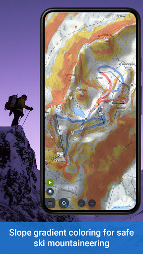
Outdoor maps by the world’s best cartographic publishers
• USA&Canada - USGS classic/satellite, AccuTerra trail maps, BackRoad Map Books,
• Europe - Ordnance Survey (UK), Kompass, Outdooractive, Freytag&Berndt (Germany, Austria, Italy), IGN (France, Belgium), CNIG (Spain), Lantmäteriet (Sweden), Kortforsyningen (Denmark), PZS (Slovenia), Compass (Poland), Swisstopo (Switzerland), SHOCart (Czechia, Slovakia) and many others...
• add external maps in SQLite, TAR, MBT, GEMF, Orux or RMA formats
Get even more with the Premium features
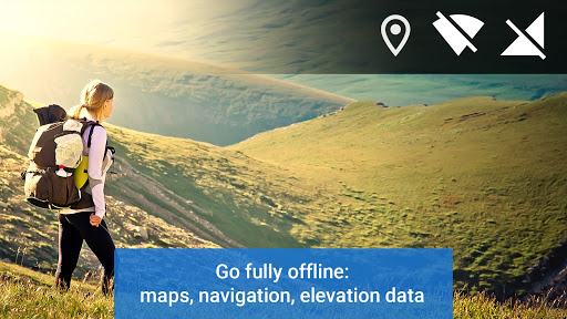
Go fully offline
• enjoy offline LoMaps of the whole world including updates without extra charges
• search offline addresses and LoPoints
• navigate and plan routes with the built-in offline router
• display elevation of any place on Earth without an internet connection
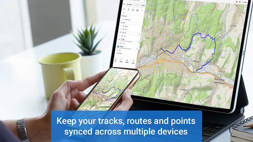
Keep synced
• use your tracks, routes, and points synced across multiple devices and your personal web library
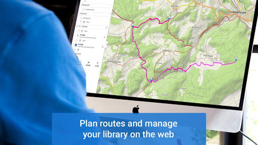
Go web
• plan routes on a big PC screen, sync them with your mobile devices
• browse, view and manage your routes and tracks in a web library
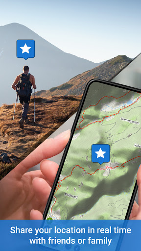
Go live
• share your location in real-time with your family or friends in your own private groups
Sport packet
• connect the app with BT/ANT+ sensors
• work out with audio coach
• monitor your rides on a dashboard with handsfree screen control
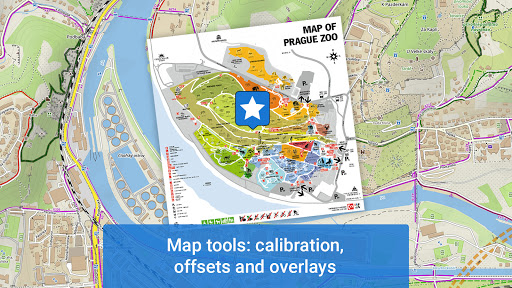
Map tools
• plan routes above a satellite map
• calibrate map images
• overlay two various maps
• set map offset
And enjoy all other Premium features of the app
• 24/7 weather forecast on any place on Earth
• parking assistant
• no ads
App uses the Device Administrator permission.
ADVERTISEMENT
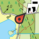
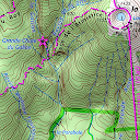
Capturas de Pantalla