ADVERTISEMENT

Measure Ground Control - Fly Drones & Manage Data
Tools
![]() 3.7
3.7![]() 5 mil+
5 mil+
Revisión del editor
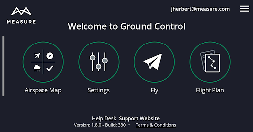
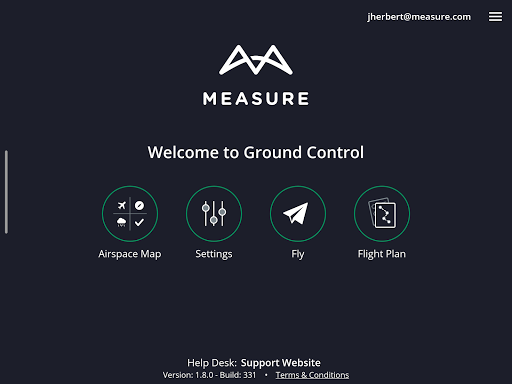
Measure Ground Control is an “all in one” drone deployment and data management software solution for UAV pilots, small businesses and large enterprises. Create a mission, plan a flight, check airspace, and process your image data in a variety of formats, such as high-quality orthomosaics, 3D maps and 3D mesh, thermal imagery, digital surface models (DSM), and many more. Manage your pilots and drone fleet, create and reuse flight plans, store and maintain fly sites, build flight schedules, run safety checklists and log flight data, as well as create customized data reports.
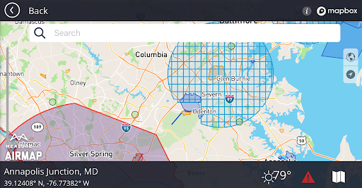
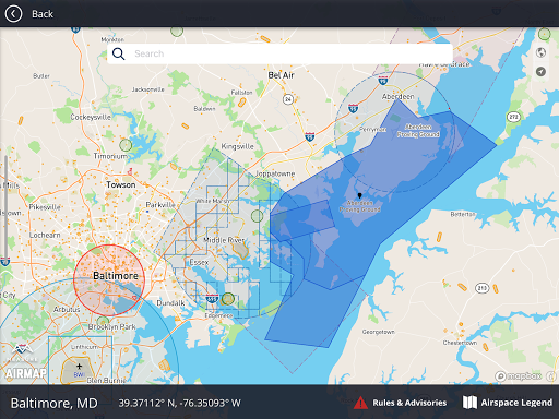
With the ability to navigate seamlessly between the web and mobile applications, Measure Ground Control features LAANC airspace authorization with built-in Airmap technology, so you can fly any airspace safely and FAA compliant. Process and create data products with our advanced photogrammetry and image processing featuring an integrated Pix4D toolkit, or inspect and annotate image data using our custom Scopito integration, all within the convenience of a single software application.
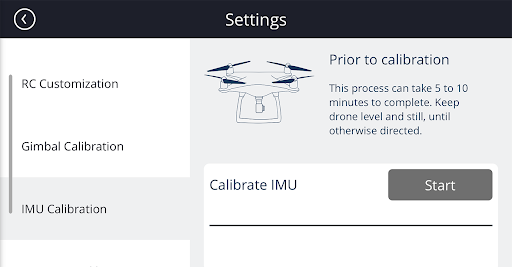
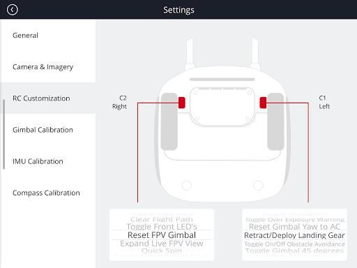
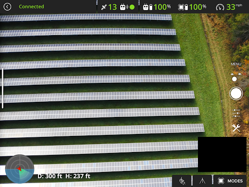
Measure Ground Control offers multiple flight modes including Panorama, Spotlight, POI, Profile, Trace, and Tripod. Additional features can be activated for Enterprise users. Built for universal DJI compatibility.
Device Compatibility
Not all Android compatible devices listed.
Samsung (S20, S10, S9+, S9, S8+, S8, S7, S7 Edge, S6, S6 Edge, Note 20, Note 10, Note 9, Note 8) Huawei (P20 Pro, P20, P10 Plus, P10, Mate 10 Pro, Mate 10, Mate 9 Pro, Mate 9, Mate 8, Honor 10, Honor 9) Vivo (X20, X9) Oppo (Find X, R15, R11) Xiaomi (Mi Mix 2S, Mi Mix 2, Mi 8, Mi 6, Redmi Note 5) Google Pixel 2XL, OnePlus (6, OnePlus 5T)
Highlights
Manual flight mode with live streaming
Grid flight mode with terrain follow
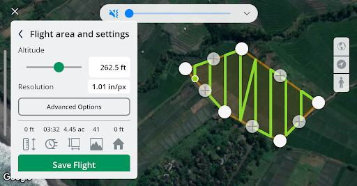
Custom waypoint flight plans
Mission creation and management
Drone fleet & pilot management
Image data processing & custom reports
Custom flight safety checklists
LAANC digital authorization request
Flight logs & realtime flight info
DJI Compatibility
Mavic (all) • Mavic 2 (all) including Smart Controller • Mavic Air 1 • Phantom 3 (all) • Phantom 4 (all) • Exception being the P4P RTK- limited functionality • Inspire 1, 1 Pro and Inspire 2 • Matrice 100/200/210 (all versions) • Matrice 600 & 600 Pro • Mavic Mini • Spark
Plan a Mission
Schedule and manage mission calendar
Assign pilots and equipment and send notifications
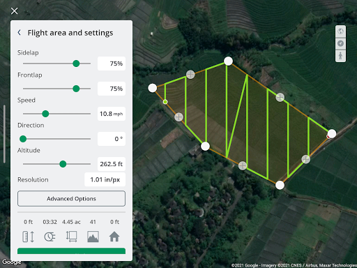
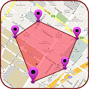
Create a flight plan with a KML file, grid or waypoint plan
Sync flight plans to the mobile flight app
Check airspace and weather
Fly & Collect Data
Request LAANC authorization
Retrieve and apply DJI Geo Unlock
Fly with GPS-aided manual control, automated grid and waypoint patterns
Use active track modes including spotlight, POI, trace, orbit and profile
Automatically upload flight logs and screen captures
Process & Analyze*
Process imagery into high-quality data products powered by Pix4D
Increase image processing accuracy with RTK drone data, or use GCPs info
Create orthomosaics, digital surface models, and contour maps
Measure linear distance and area or add a 2D image layer to your map
Analyze data with our integrated Scopito annotation tool
Report and Store Data*
Store unlimited flight logs, imagery, video, and uploaded files
Track activity and compliance with built-in reports
Export and share data products (orthos, DSM, contours) as GeoTIFF or GeoJSON files
Add inspection results and review mission and portfolio-level summaries
Upload completed data products to each mission
Manage Operations*
Access automatically uploaded flight logs, including flight playback and screen captures
Check automatically flagged incidents for activity outside of safety best practices
Add users, setup user profiles, control user permissions with pre-defined roles
Manage equipment with automatic usage tracking
Track program activity with dashboards and exportable PDF and CSV reports
*Features only accessible via the Measure Ground Control web application.
ADVERTISEMENT
Capturas de Pantalla