ADVERTISEMENT

Memory-Map
Maps & Navigation
![]() 3.8
3.8![]() 100 mil+
100 mil+
Revisión del editor
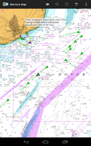
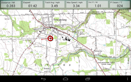
The Memory-Map app turns your phone or tablet into a full-featured Outdoor GPS or Marine Chart Plotter, and allows you to navigate with USGS Topo maps, NOAA Marine charts, and may other specialist maps, even without a wireless internet signal.
Maps are downloaded on-the-fly and can be pre-loaded so that they can be used offline. Once the app and maps are loaded to the phone or tablet, cellular network coverage or internet connection is not required for real time GPS navigation.
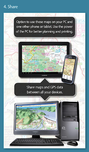
The Memory-Map app can be used as a standalone GPS navigator, but it can also be used in conjunction with the Windows PC or Mac app (free download) for planning, printing and loading up maps, waypoints and routes to the phone/tablet.
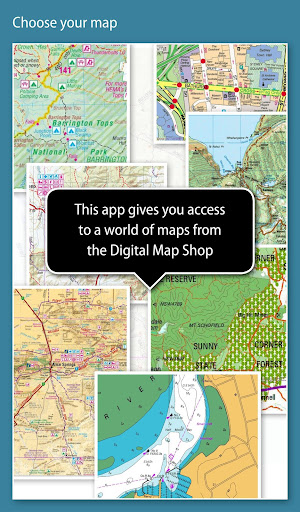
Memory-Map includes free access to 1:250,000 scale topographic maps and many other free maps around the world. More detailed maps are available for download and purchase with a free try-before-you-buy, time-limited demo option. Available maps include Ordnance Survey, Hema, USGS quads, NOAA, British Admiralty, and DeLorme. Maps can be used on your PC as well as your phone and tablet. The Cloud Sync feature allows you to keep the overlay data consistent on all your devices.
Features include:
Access a vast range of Worldwide maps and charts.
Automatically downloads a free map of your current location
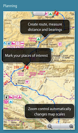
Create and edit marks and routes.
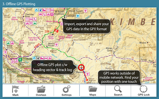
Import and export marks, routes and tracks in the open GPX format
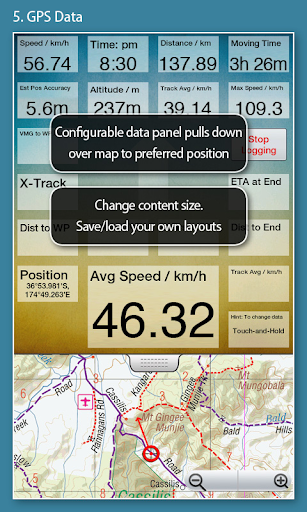
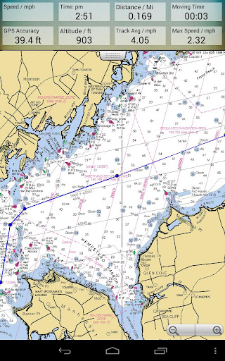
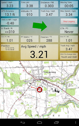
Display; Position, Course, Speed, Heading, Altitude and averages
Position coordinates include Lat/Long, UTM and GB Grid
Units displayed in Statute, Nautical or Metric
Support for GPS and Compass sensors, where available.
Placename index, can be used offline.
Moving map, lock GPS position and automatically scroll the map
Records breadcrumb trail / tracklogs.
Share position marks or tracklogs as GPX files
Proximity Alarm
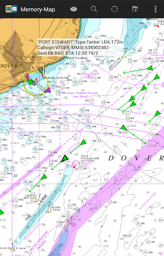
Full marine instrumentation features, with AIS, DSC and Anchor alarm
NMEA data interface via WiFi or Bluetooth
AIS collision alarm, with adjustable thresholds for Class A and Class B targets
Display Alarm notifications and Nav data on Android Wear watch
Barometer & relative altitude
ADVERTISEMENT
Capturas de Pantalla