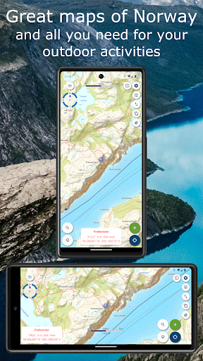
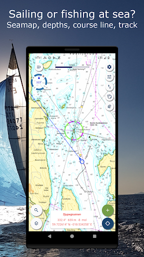
Norgeskart Outdoors has all what you need for hiking, biking, boating, snowmobile or skiing. Everything can be made available for offline use without mobile coverage. Includes topographically maps for Norway, Svalbard, Jan Mayen and Sweden. Now also with altitude (including depth at sea) and place name for any given location in Norway!
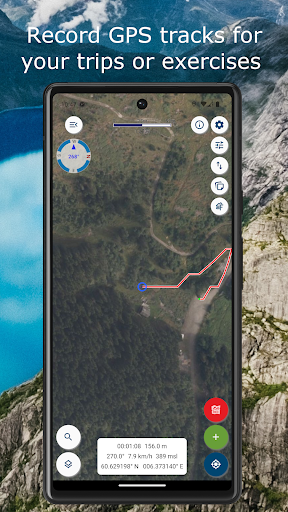
Record GPS tracks, register points of interest (POIs) and routes. Registered data can, if desired, be written to GPX files or uploaded to the map portal norgeskart.avinet.no. You can then look at your own data in the browser and easily transfer between phones and tablets. In the app you can also read content from GPX files that you find on ut.no or other sources.
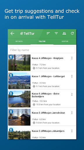
Plan your next trip by downloading trip suggestions and descriptions from TellTur. Everything available regardless of mobile coverage. With TellTur you can register with the app when you arrive at a destination and compete with others to visit most places. You can easily find current trips by filtering and sorting the list of hiking destinations from your location or center of the screen.
This app contains both free and paid content (see complete overview below). By paying for a subscription, you support the further development of the app and take full advantage of all the exciting things we have to offer.
Free content:
------------------
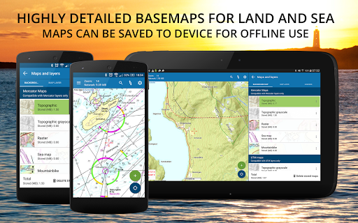
- Topographical and nautical maps for Norway, Svalbard and Jan Mayen
- Trip suggestions and check in for telltur.no (free in 2022)
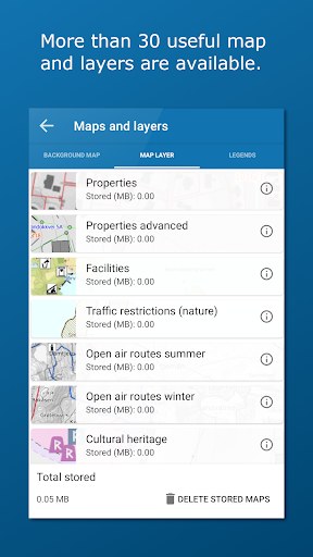
- Map layer with anchorages for Norway
- Altitude and place name for crosshair location in Norway.
- Search for addresses, place names and coordinates.
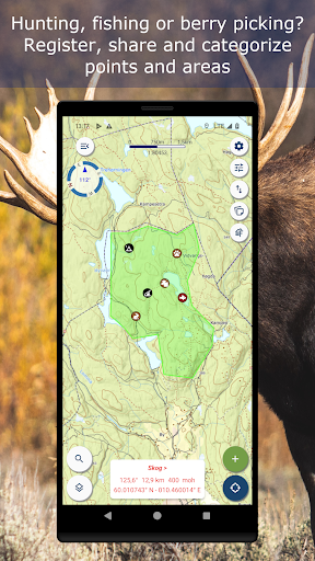
- Property borders and UTM grid layers
- Record GPS tracks
- Import and export of GPX files
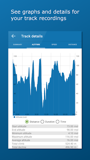
- Display imported tracks as graphs.
- Create own routes and POIs
- Compass
- Driving directions
Premium subscription:
------------------
- Topographically maps of Sweden.
- Download maps for offline use (Sweden limited to storage by panning and zooming)
- Access to map portal norgeskart.avinet.no
- Upload POIs, tracks and routes
- Synchronize your data across devices
- Advanced properties layer (cadastre)
- Outports. Not nationwide.
- Sea depts
- Lake depths
- Activities (bath spots, campfires etc). Not nationwide.
- Facilities (toilets, parkings etc). Not nationwide.
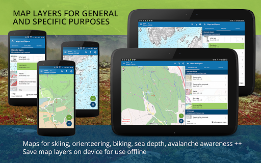
- Mountain bike routes for Scandinavia
- Pistes Alpine and Cross-country for Scandinavia
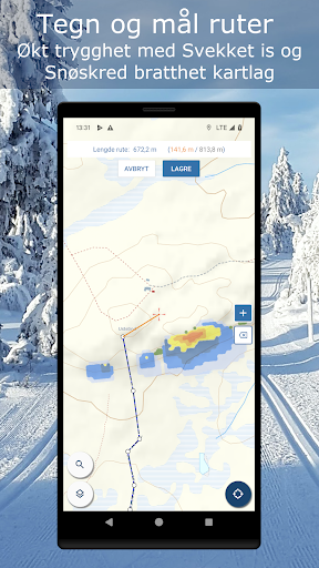
- Avalanche awareness and steepness
- Weak ice
- Snow depth and skiing conditions
- Snowmobile tracks for Scandinavia
- Conservation areas
- Traffic restrictions (nature)
- Clay and radon
Dynamic point subscription:
------------------
- Connect to one or more dynamically updated KML files on the internet
- Tested against telespor.no for tracking sheeps