ADVERTISEMENT

Outdooractive: Hiking & Biking
Travel & Local
![]() 3.8
3.8![]() 1 M+
1 M+
Revisión del editor
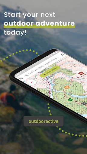
The Outdooractive App for smartphones, tablets & Wear OS is the perfect companion for hiking, cycling, mountaineering and other outdoor activities. With the app you can find and plan routes around the world with ease.
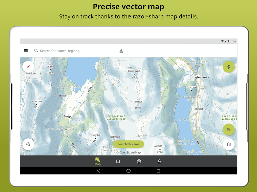
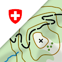
Latest vector maps provide accurate information about hiking and cycling trails, via ferratas, protected areas and details about many other outdoor activities.
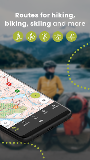
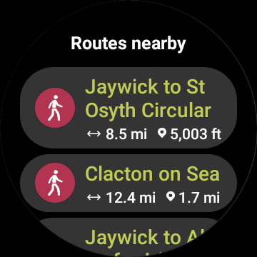
Global Trail Database:
Browse through countless route suggestions for hiking, cycling and ski touring. All routes come with full details, elevation profiles, photos and directions.
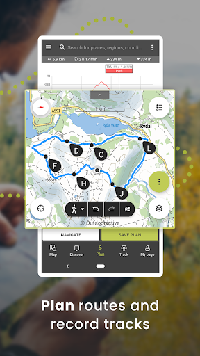
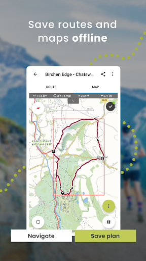
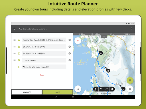
Outdoor Route Planner:
Our Route Planner lets you easily plan and create routes based on your preferences. You can add text and photos to these, publish them within the Community or share them privately with friends. You can also import and export GPX files as required.
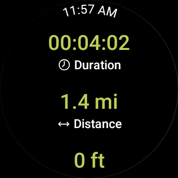
Recording your own Tracks:
The tracking function allows you to record your own tracks to include duration, distance, altitudes and an interactive altitude profile.
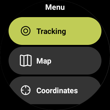
Smartwatches with WEAR OS from Google:
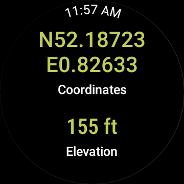
Save maps to your watch and use them offline, letting you leave your phone at home. Record tracks and upload them directly to your account. Works without a data connection
Challenges:
Join one of our walk, cycle, climb or run challenges. Pick your activity and choose the distance to complete this year.
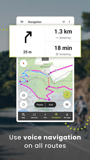
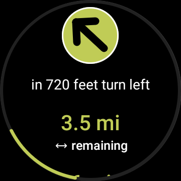
Navigation:
The navigation function with speech output lets you navigate comfortably from A to B on all routes.
BuddyBeacon:
Safety first: Share your real-time location with friends and family.
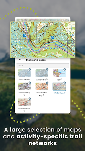
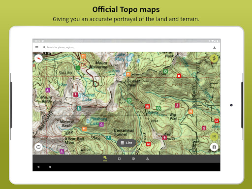
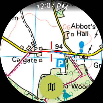
State-of-the-art map technology:
Enjoy a high-resolution display of all maps and at all zoom levels thanks to our state-of-the-art vector technology. Our digital summer and winter layers are based on OpenStreetMap and Pro and Pro+ members can also benefit from many other maps.
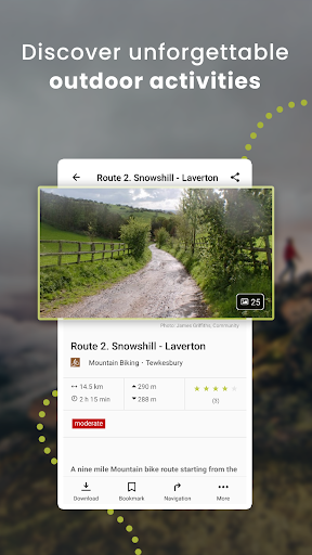
A Global Outdoor Travel Guide:
Helpful filters and our powerful search functions help you not only find routes, but also sights, accommodation, events and ski resorts.
A Large Directory of Mountain Huts:
Opening times, availability and prices as well as further information can all be found in our mountain hut directory. Created in partnership with the German Alpine Association (DAV), the Austrian Alpine Association (ÖAV) and the Alpine Association for South Tyrol (AVS).
Exclusively for Pro members
Go anywhere : Outdooractive Pro works offline without mobile and data signals. Unlimited lists can also be created and the app is ad-free. In addition, you are able to view satellite imagery, the unique Outdooractive map with over 30 activity trail networks and official topographic maps from the following providers:
Great Britain Ordnance Survey, Landranger, Explorer
New Zealand Land Information
Utah USGS
Germany BKG
Austria BEV
Switzerland swisstopo
France IGN
Spain CNIG
Italy Edizione il Lupo, 4Land and others
Netherlands PDOK
Norway Kartverket
Denmark Kortforsyningen
Sweden Lantmäteriet
Finland National Land Survey
Japan GSI
Global Map
Exclusively for Pro+ members
Pro+ also contains official maps from Alpine Associations as well as premium maps from KOMPASS and certified Premium Routes from KOMPASS, Schall Verlag and the ADAC hiking guides.
If you have questions or suggestions, please visit https://www.outdooractive.com/en/helpcenter/
ADVERTISEMENT
Capturas de Pantalla