ADVERTISEMENT

PeakVisor - 3D Maps & Peaks ID
Travel & Local
![]() 3.5
3.5![]() 10 mil+
10 mil+
Revisión del editor
PeakVisor will make you a superhero of outdoors navigation by putting state-of-the-art 3D maps and mountain identification in the palm of your hand.
"PeakVisor is a seemingly magical app that instantly recognizes the name of any mountain peak that comes into view using a combination of your phone’s camera" - Atlas & Boots
"A lovely little app that uses your phone’s camera and the power of augmented reality to identify any mountain you aim the camera at." - Digital Trends
Key Features:
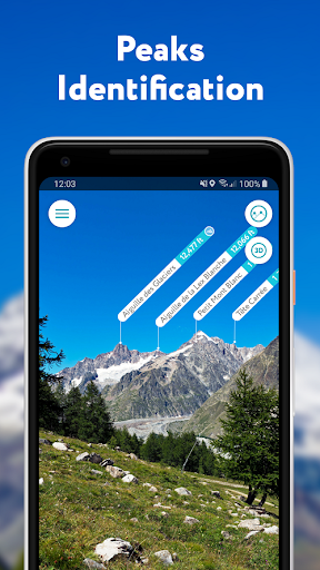
● Mountains Identification
Identify more than a million hills & mountains all over the world and get a detailed profile for each one of them, including altitude, topographic prominence, mountain range, what national parks or reserves it may belong to, as well as photos and Wikipedia articles. It is one of the most useful Augmented Reality technology applications on the market today.
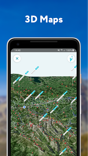
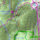
● 3D Maps
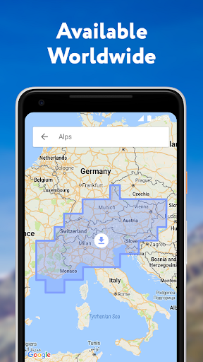
Get your topo maps of the future. Cutting edge technology with high-precision terrain modeling allows simple, yet effective insight into the landscape of the mountains. It is the most convenient way to explore a mountainous area, its trails, summits, passes, viewpoints, and even parking areas.
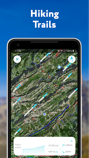
● Hiking Route Planner
A vast network of worldwide hiking trails and walking pathways included in PeakVisor’s 3D Maps will help you compose a hiking route, which includes, evaluating the distance you can expect to hike, as well as a route’s elevation profile, and estimated time for completion. To help you plan your route we’ve included points of interest in our 3D Maps such as mountain huts, parking lots, cable cars, viewpoints, castles, etc.
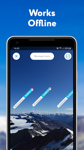
● Everything works Offline
Internet connection is not a prerequisite for the PeakVisor app. All the data is downloadable and ready for use no matter where you are or what altitude you might be at.
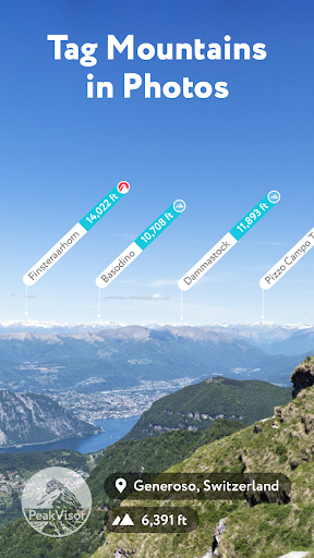
● Identifying Mountains in Photos
If you have photos from previous hikes that you did not take through the app, you can still find out what peaks you saw by download your images into the PeakVisor app and adding a digital overlay of the mountains with names and altitudes of all the peaks in view.
● Photo Planning
PeakVisor’s Sun and Moon trajectories come super handy when planning the perfect time to take pictures.
PeakVisor is the Swiss army knife of outdoor adventure and will soon be indispensable to you future hiking needs. Just keep it in your backpack and you'll get value from it every time you’re on the trail!
If you have any questions or just feel like talking about mountains, please contact us at [email protected]
ADVERTISEMENT
Capturas de Pantalla