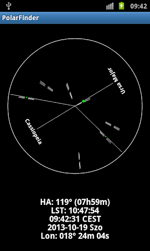
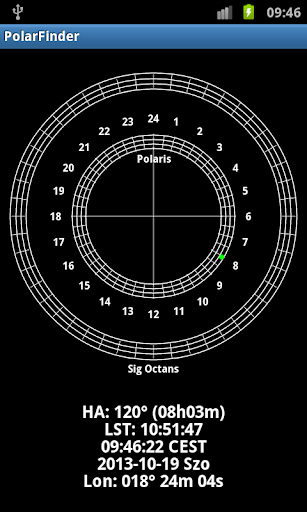
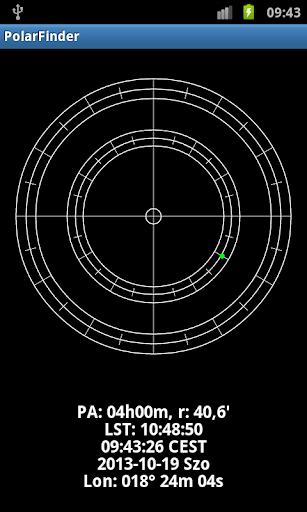
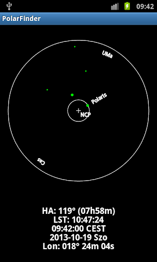
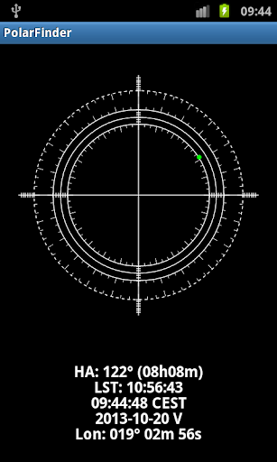
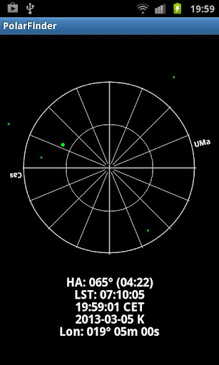
When astronomical observations or imaging is done using an equatorial telescope mount, the right-ascension (RA) axis should be parallel with the rotation axis of the Earth to avoid star-trails and errors in guiding. The method how we achieve it is called polar alignment and it starts with a rough alignment of the RA axis. The best aid for this is to use a polar finder scope with a reticle. On the reticle the Polar star (and the Octant for the Southern hemisphere) is engraved and should be positioned over the real Polaris by turning it. Because the Polaris is not exactly coincide with the Earth's rotation axis but rotates around it, one should know the exact hour angle of the Polaris to adjust (rotate) the finder.
This utility helps you solve this problem by graphically showing you the current position of the Polaris. The application tracks and draws the position of the Polaris (or Octant) in real-time and also displays its hour-angle, the local sideral time, current local time and the longitude of the place. The longitude can be entered manually or obtained using the built-in GPS. The view on the display can be mirrored to match the view in your polar finder scope. Key features are as follows:
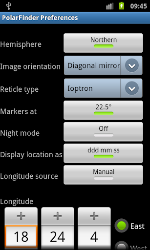
• Northern, southern hemispheres
• Naked eye, telescopic view
• Customizable marker angle
• Support for: Astro-Physics, AstroTrac, Ioptron, Losmandy, Skywatcher, StarAdventure, Takahashi and Vixen eyepiece reticles
• Precession
• Night vision mode
• Enter longitude of your place manually or via built-in GPS
Note: On some new devices running Android 4.x the preferences menu can be reached via pressing and holding the Recent Apps Button - which is a ‘soft key’ (not the Home button). On Galaxy Tabs there are three buttons at the bottom. The middle one is the main, hardware button. The task manager is just on its left side. Press and hold for about two whole seconds on it, and then the menu comes up.