ADVERTISEMENT
RadarOmega
Weather
![]() 3.4
3.4![]() 10 mil+
10 mil+
Revisión del editor
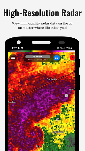
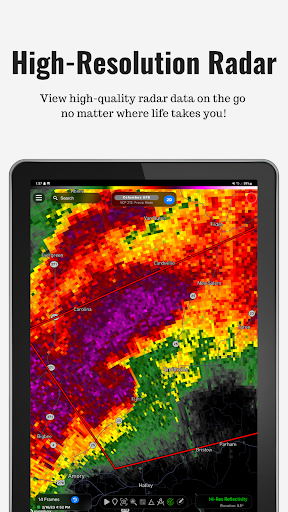
Welcome to RadarOmega, the next generation weather app that takes high resolution weather data to a whole new level. RadarOmega provides the highest resolution radar data with the ability to interface with cyclonePORT and connect several types of weather sensors.
RadarOmega users now have the ability to interface with the Tempest WeatherFlow weather station. Connect directly via the Tempest API or use cyclonePORT to stream your station data. Users can also use cyclonePORT to connect the Davis WeatherLink to stream sensor data.
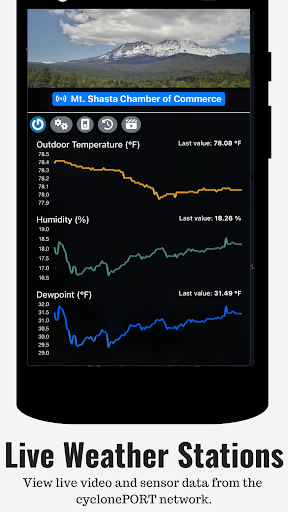
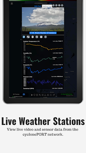
View our growing cyclonePORT network of live streaming sensor/video stations, track research teams as they deploy sensor probes in the path of the most extreme weather, and more!
RadarOmega provides high resolution radar data for the following countries:
United States
Canada
Germany
Australia
South Korea
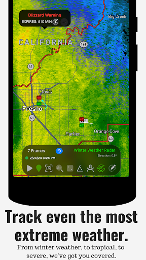
Most weather applications, especially "FREE" ones, provide oversimplified data that is slow to update and very distorted. Our goal is to educate the public on how these apps can be dangerous in life threatening situations and the overall usefulness of having a high-quality radar application for everyday life.
Other Data Overlays:
-Lightning Detection
-24 Hour Storm Reports
-SPC Outlooks - Watches - Mesoscale Discussions
-NHC Outlooks - Tropical Weather Outlooks, Active TS/Hurricane Tracking
-Hydrological Outlooks
-Winter Weather Outlooks
-Surface Fronts
-Real-Time NWS Storm Based Warnings
-METARS Data Layer
-Tidal Forecast Charts
-Buoy Data
-NEXRAD Hail History
-Spotter Network Locations (soon more robust for SN users)
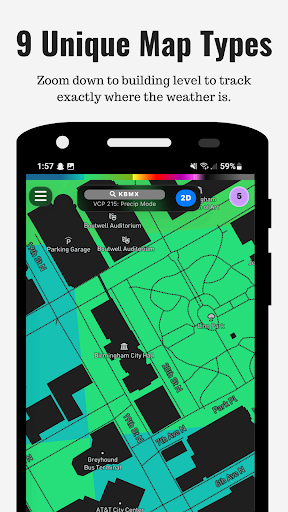
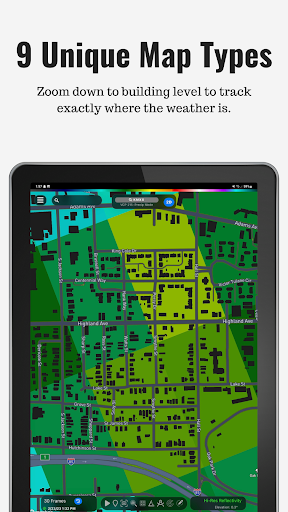
-Map Type Customization
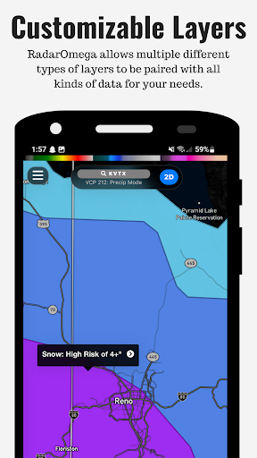
-Detailed City & Road Network Overlay on top of radar data
-Save Custom Locations
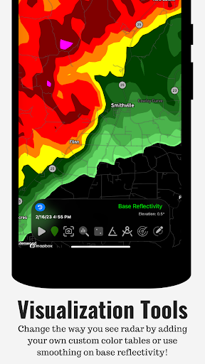
-Drawing, Data Viewer, and Distance tools
-Share GIF and Videos of Radar Animations
-Day/Night Time Layer
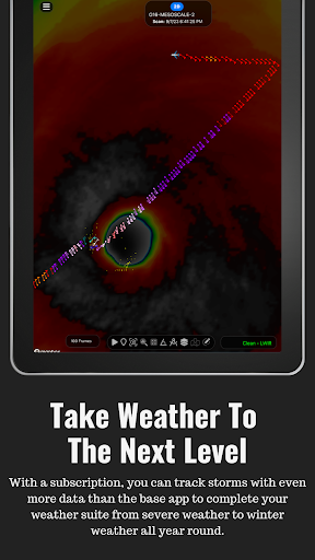
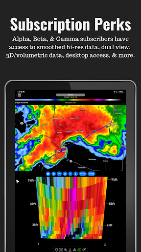
If you want MORE data, we do offer subscription services. More information on what we offer in our subscriptions can be found on our website and inside the RadarOmega app.
Subscriptions:
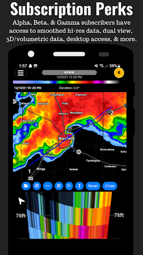
Desktop Access is only available to all RadarOmega Subscribers.
Gamma
- 75 Frame Animations for Radar
- 30 Frame Animations in Dual View
- Smoothing for Radar and Satellite
- Radar History with 75 Frames
- 6 Month Storm Report Archive
- Desktop Access with Dual Panel
- National Digital Forecast Database
- Satellite Data
- Dual View Display for Radar/Satellite
- Smoothing for Radar and Satellite
- 3D Radar/Satellite
Beta
- - -Everything in Gamma PLUS- - -
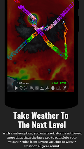
- MRMS Data
- 150 Frame Animations for Radar/MRMS/Satellite
- 50 Frame Animations in Dual View
- Radar History with 150 Frames
- 5 Year Storm Report Archive
- Smoothing for MRMS
- 3D MRMS
Alpha
- - -Everything in Beta PLUS- - -
- Model Data
- 250 Frame Animations for Radar/MRMS/Satellite
- Radar History with 250 Frames
- 100 Frame Animations in Dual View
- 50 Frame Animations in Quad View
- Desktop Access with NEW Experimental Quad Panel
- 10 Year Storm Report Archive
Subscriptions are maintained through the Play Store. We will work with our customers however refunds must be done through the Play Store. Please be sure to reach out to our support team if you have any problems, questions, or concerns.
For Support- You can create a ticket and we will resolve it as soon as possible:
https://radaromegawx.supportbee.io/portal/sign_in
See our Terms of Service below:
https://www.radaromega.com/terms.php
ADVERTISEMENT
Capturas de Pantalla