ADVERTISEMENT
Shapefile over Map
Tools
![]() 3.8
3.8![]() 1 mil+
1 mil+
Revisión del editor
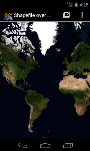
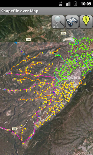
Load your own shapefiles with this Geographic Information System (GIS) directly from the sdcard of your mobile device and visualize them over a map. You can also edit the values of its dbf table and use it in offline mode, loading maps from your memory card.
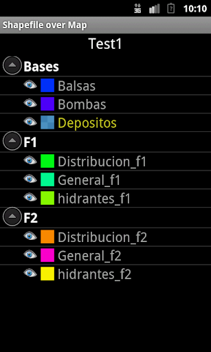
With this GIS application, you can select and load a shp file or load an entire folder automatically.
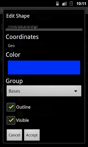
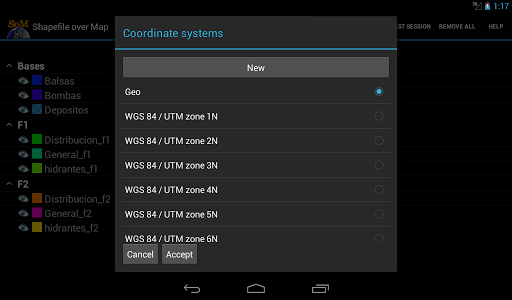
You can select one of these shp files and mark it as the active layer and if you use a long press over one of them you can change its coordinate system, its color or make it invisible.
The map will display a series of icons, belonging to each of the records in the active layer, which when pressed will allow you to view and edit information from its corresponding attribute table.
The application also allows you to view your current position via GPS and center the map on it.
You can choose between several online map servers.
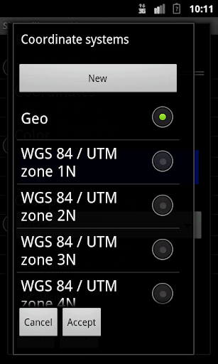
Support for all UTM Projections (WGS84, SAD69 and NAD83)
The .prj file is readed and the coordinate system is automatically assigned.
Now you can save your sessions (a configured shapefile list).
Now also includes a tool to measure distances, areas and perimeters.
New tool to search shapes by dbf field value
New functionality to add and delete dbf fields
New functionality to add WMS servers
A Quick Help has been added
New drawing system. Now move the map is faster
More memory available to load larger shapefiles(only in Android versions 3.0 or later)
New layers administration system
New tool to load the last session
New auto zoom tool to the active layer
New Settings option to change measure units, GPS update time and character codifications
To use a map in offline mode, simply download it previously (for example using Mobile Atlas Creator (using OsmAnd tile storage format)). You must copy the map to the folder you have set on settings and it should be in the format MAPNAME/ZOOM/X/Y.png.tile
ADVERTISEMENT
Capturas de Pantalla