ADVERTISEMENT
Topo GPS
Maps & Navigation
![]() 50 mil+
50 mil+
Revisión del editor
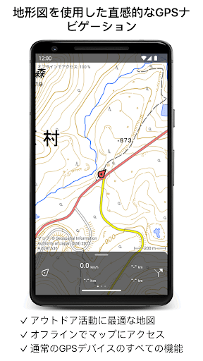
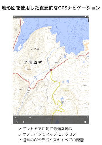
Makes from your phone or tablet a complete GPS device with detailed topographic maps. Viewed maps will be stored on your device so that Topo GPS can also be used offline.
Why should you buy an expensive GPS device if you can install Topo GPS? Topo GPS contains all functions of a regular GPS device for less money, has a much more detailed map, and is more convenient to operate. The accuracy of the position determination is in favorable conditions about 5 m.
Ideal for walking, hiking, cycling, mountain biking, sailing, horse-riding, geocaching, scouting, trail running and other outdoor activities. Also suited for outdoor professionals.
Map
* To use Topo GPS you need to buy a map.
* Official topographic maps of many countries, including USA, Great Britain (OS Explorer), New Zealand and Australia are available as in-app purchase.
* Topographic maps are very detailed maps, include height contours and are very suited for outdoor activities.
* All maps of a certain region can be made offline accessible using the map download screen.
* Easy switching between maps.
* OpenStreetMap with height contours for worldwide coverage.
* Aerial imagery of a few countries including USA.
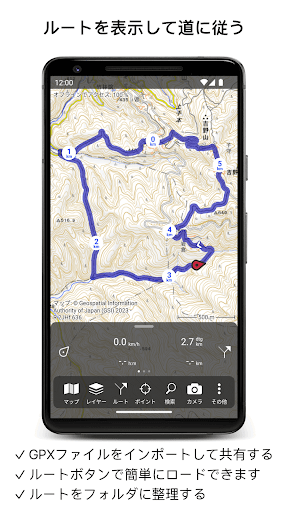
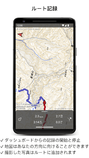
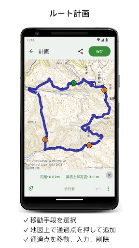
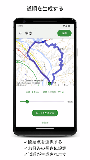
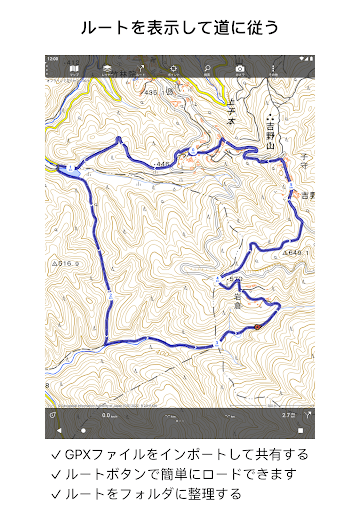
Routes
* Recording routes, with pause and restart possibility.
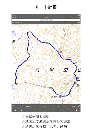
* Planning routes via route points.
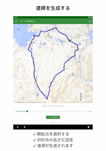
* Generating routes
* Editing routes
* Searching routes with filters.
* Routes can be organized into folders.
* Height profiles
* Importing and exporting routes in gpx/kml/kmz format.
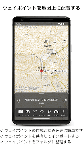
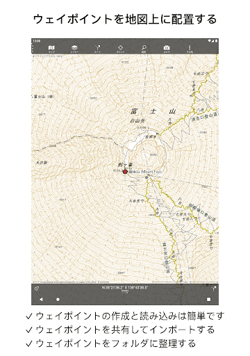
Waypoints
* Easy adding by pressing long on map.
* Adding waypoints through address or coordinates.
* Editing waypoints.
* Importing and exporting waypoints in gpx/kml/kmz/csv/geojson format.
Layers
Layers contain information that can be added to and removed from the map.
* Long distance bicycle routes
* Mountainbike routes
Coordinates
* Easy entering coordinates
* Scanning coordinates
* Supported coordinate systems:
WGS84 decimal, WGS84 degree minutes (seconds), UTM, MGRS, and other country specific coordinate systems.
* Coordinates grid layers
Intuitive interface
* Clear menu with most important functions.
* Different dashboard panels with distance, time, speed, altitude and coordinates.
* Clear manual at www.topo-gps.com
Supported file formats
* gpx, kml/kmz (all also zip compressed), csv
If you are recording a route, the GPS will run in the background. The battery of your device will be emptied faster, when using the GPS in the background.
Rdzl, the company behind Topo GPS, cares very much about your privacy. The Topo GPS app does not have user accounts. We do not obtain in any way the position of the user of Topo GPS. Rdzl does also not obtain any data created or imported by the user, like routes and waypoints. We only obtain a route if it is shared manually by the user with Topo GPS. Ads are not shown in Topo GPS. We sell our product, not our user data.
Privacy policy: https://www.topo-gps.com/privacy-policy
Terms of use: https://www.topo-gps.com/terms-of-use
ADVERTISEMENT
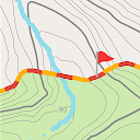
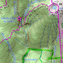
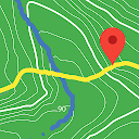
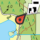
Capturas de Pantalla