Plan a bike route, cycle through backroads, go dirtbiking, and explore the outdoors with Trailforks. Download the perfect backcountry companion for your next bike ride with reliable road maps to guide you along the way. Each cycling trip helps local trail associations curate the over 350,000 trails available for you to navigate.
Outdoor exploration awaits this spring with cycling maps to use on your next bike route! Use our app to access the Trailforks website for powerful bike tracker features and free maps!
TRAILFORKS FEATURES
BIKING APP FOR EVERYONE
- Find mountain bike trails in the world’s largest database!
- Filter biking routes by type – great for adaptive bikers or ebikes
- Biking Tracker: Cycling maps & trails with GPX compatibility. Sync with your Garmin device
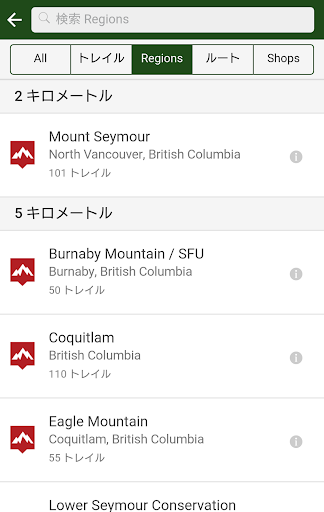
- Download road maps and create local routes during your hike or bike ride
- Free Maps, backroads and personalized recommended routes are waiting to be explored
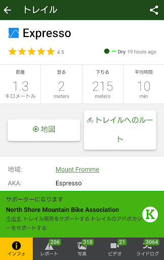
- Route & region info available with over 650,000 photos & videos
- Bike shops are shown on the map with quick links for directions or phoning the shop
- Cycle through backcountry routes with fatbike trails
- View bike route information with average time to complete
HIKING, RUNNING & MORE
- Trailforks is perfect for Mountain Biking, Hiking, Trail Running, Dirtbiking, Observed Trials, Horse Riding, & more!
- Road maps cater to your preferred sporting activity
- Our free maps include thousands of related activity POI's
- View custom worldwide topo maps designed for outdoor sports
- Hiking Maps: View topographic maps to discover, plan and explore routes and trails
BIKING A BETTER WAY WITH RIDELOGS
- Discover new backroads when you view your friends Ridelogs
- Prepare for your bike ride with other users’ Ridelogs
- Cycle and support the areas you ride by donating 'Trail Karma'
- Read and comment on routes & rate them
- Share cycling routes, rides & trails with friends via QRCode
GPS NAVIGATION
- Use Trailforks as your own bike GPS for seamless trail navigation
- Walking GPS, run tracker, route tracker and more
- Run Planner: Running GPS navigation makes Trailforks the perfect running route planner
- Use your phone’s compass to orientate the map in the direction you’re facing
TOPOGRAPHIC MAPS AVAILABLE ONLINE & OFFLINE
- Offline topo maps and info. Region updates are incremental and fast
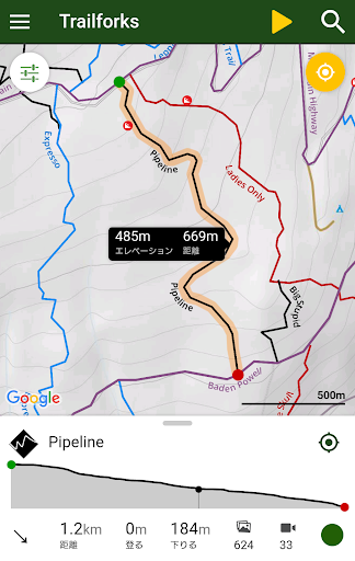
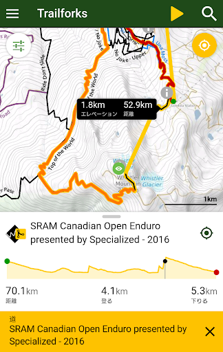
- Route elevation profiles are displayed easily
- Explore road maps with an ever-growing list of routes
- Toggle Pro map layers such as slope angle, light pollution, USFS, land ownership, avalanche data and more!
- View popular Strava segments on the map to up your game
- Overlay of US land owners like the BLM
- View polygons such as private property areas or closed areas
- Automatic route creation from your location to the trailhead of your choosing
- View elevation profiles with grade of climbs and descents
- Outdoor activity recording available with Trailforks and even sync to Strava.
TRAIL EVENTS, STATUSES & ALERTS
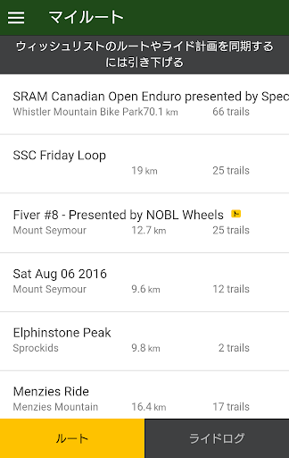
- Save trails to your Wishlist
- View upcoming events nearby or by specific region
- Share your map location with a friend or emergency services
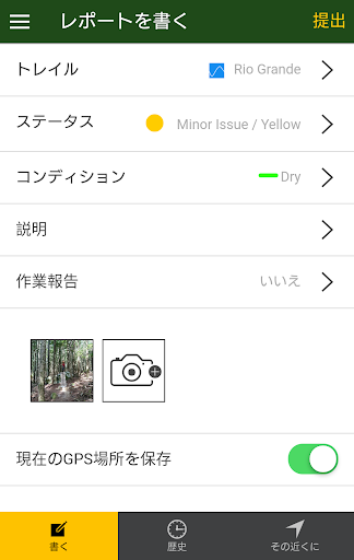
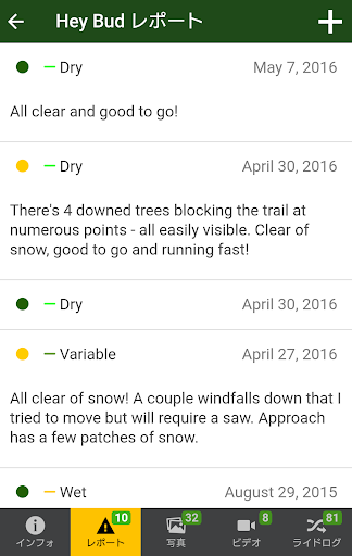
- Stay up-to-date with trail conditions & closures
- Submit trail reports & conditions from the app, including taking photos of trail issues
- View local trail badges you can earn by recording your rides
- Sync and view your saved 'Route Plans' from https://www.trailforks.com/ridelog/planner/
GetTrailforks Pro to view full map details outside a city-sized area of your choosing!
Set out on your next bike ride with the best routes and outdoor experiences on Trailforks. Navigate the backcountry and share your experiences with the Trailforks community when you download today!
Detailed trail maps of popular mountain biking destinations such as, Whistler, Squamish, North Shore, Kamloops, Nelson, Moab, Sedona, Park City, Hurricane, Downieville, Colorado Springs, Bellingham, Bentonville, Finale Ligure, Pisgah, Marin, Bend Oregon, Wellington & Rotorua New Zealand.